This portfolio documents my work in spatial analysis and conservation combining professional experience in environmental management with ongoing development in remote sensing and reproducible workflows in R.
Topographic Analysis of Alto Mayo and Cordillera de Colán Protected Areas
Slope and elevation analysis of two protected areas in northern Peru.
Full document
RStudio R
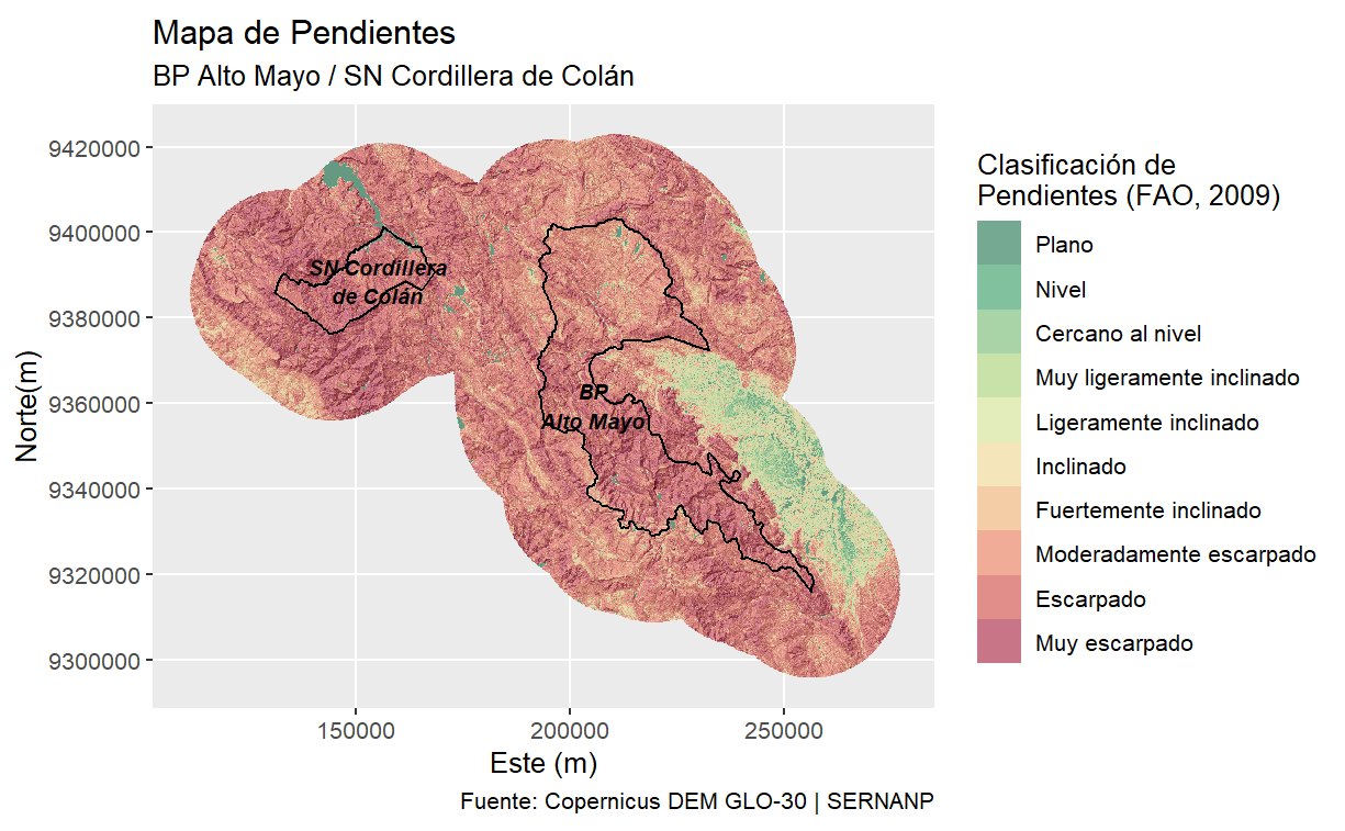
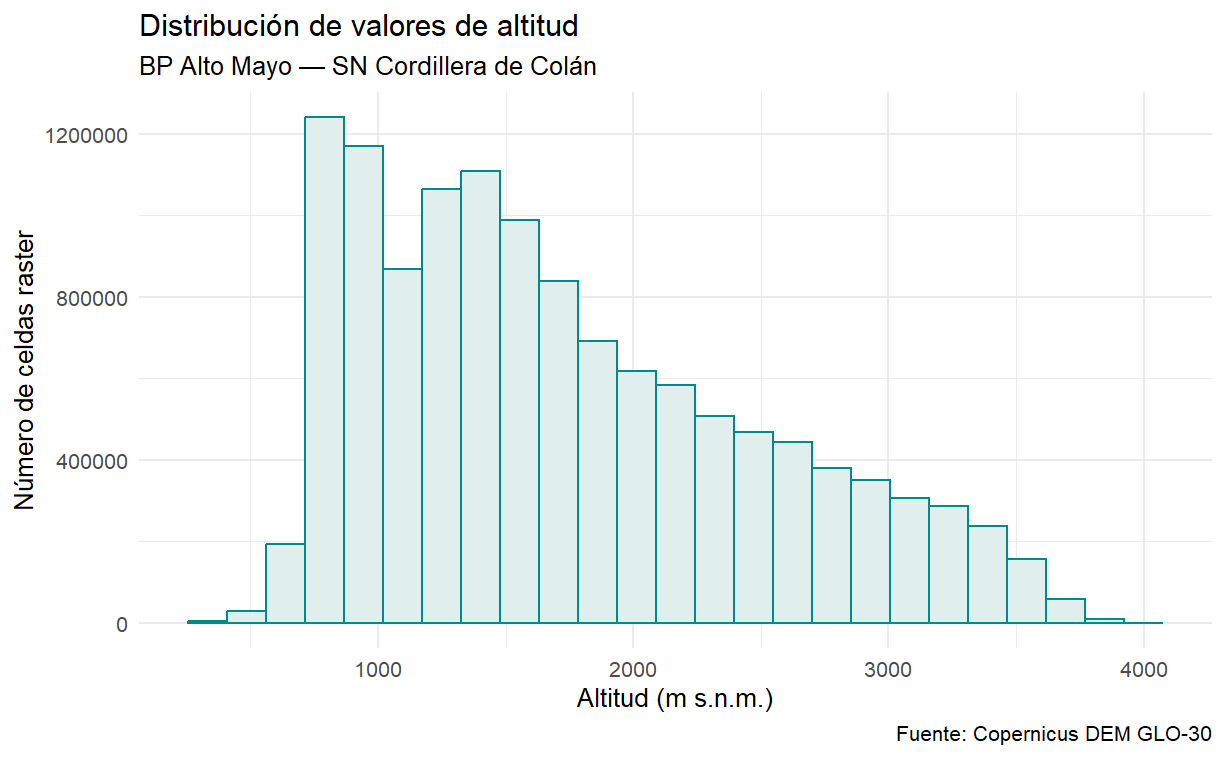
The Bosque de Protección Alto Mayo (BPAM) and Santuario Nacional Cordillera de Colán (SNCC) are two protected areas in northern Peru that form part of the Abiseo-Cóndor-Kutukú transboundary conservation corridor. Using R, I processed a 30m Copernicus DEM to generate a classified slope map and an elevation histogram for a study area encompassing both protected areas and a 20 km buffer zone. Over 81% of the area has steep to very steep slopes (>15%), with a highly variable elevation range of 332–3,998 m.a.s.l. (SD = 761 m), reflecting the complex Andean-Amazonian transition landscape.
Elevation distribution across the study area. Values range from 332 to 3,998 m.a.s.l. with high variability (SD = 761 m). The positively skewed distribution — with most cells concentrated below 1,000 m — reflects the dominance of mid-elevation Andean slopes transitioning into lowland Amazon forest.